So what is the cause for the incoming cold? Well a substantial ridge of high pressure has been building across the western-tier of the United States and extending into western Canada. This ridge is in response to an increasing state of the Pacific-North American teleconnection pattern. The response here across the northeastern United States will be for a very sharp trough and associated Arctic cold front to push through. On the backside of this front, our airmass will be deriving straight from the Arctic, hence the early season, albeit brief, cold. We can see below:
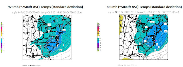
What does this translate to in the lower levels of the atmosphere and at the surface? You get it...cold. We are looking at temperatures between about 2500ft and 5000ft ASL as much as -3 to -4 standard deviations below-normal come Sunday morning!
Here is one computer model's forecast projection (The GFS model) for 2-meter temps both around 5 AM Sunday morning and 5 AM Monday morning. The GFS shows temperatures about 2M off the ground well in the mid to upper 20's, which actually means some of the typically colder locations may even see temperatures each the lower 20's!


No comments:
Post a Comment