Typically setups like this are on the rare side, however, what is opening some eyes with this setup is the potential advection of an elevated mixed-layer plume working in from out west. For more on elevated mixed-layers, their origin, and importance in higher-end severe weather events please read this more detailed information provided here:
http://weatherwiz.blogspot.com/2015/06/what-is-elevated-mixed-layer.html
To explain EML's as simply as possible, they are capping inversions which prevent clouds, showers, and thunderstorms from developing too early and this allows for stronger heating and can lead to extreme amounts of instability developing below the capping inversion depending on how high the temperatures are and how high the dewpoints are.
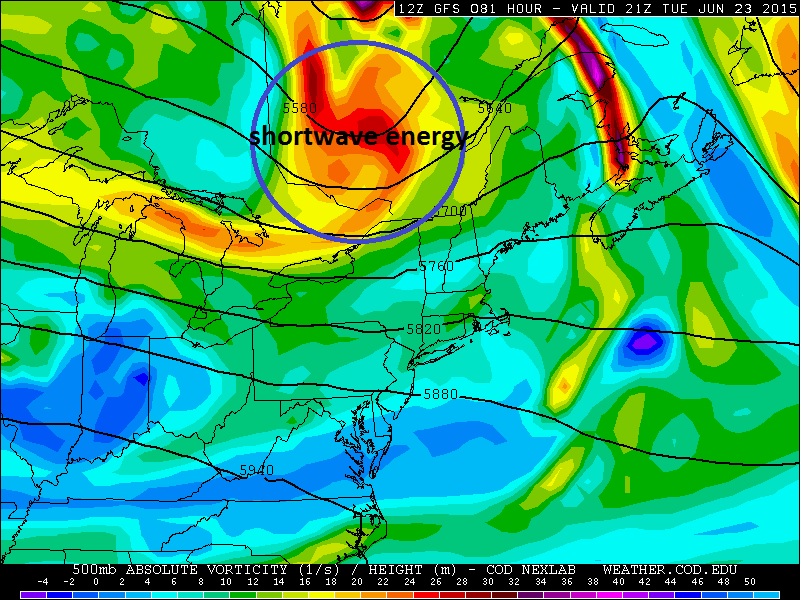
Computer forecast models are showing a very strong piece of shortwave energy passing just to the north of the US/Canadien border. This track may favor the greatest risk of severe storms being further north across New England, (central/northern MA into portions of VT/NH and into ME so the track of the s/w will have to be watched closely:
Computer forecast guidance also develops some extreme instability across the region with Cape perhaps as high as 2500-3000 J/KG and very strong wind shear, both speed shear (increase of winds with height) and directional shear (change of wind direction with height). This combination could lead to the potential for any thunderstorms that develop to become quite severe and have the potential to produce damaging winds, large hail, and perhaps even a tornado.
Below is the 12z NAM bufkit for Windsor Locks, CT late Tuesday afternoon. This is a pretty alarming sounding with extreme instability, high shear, and very high helicity being forecasted. This is something seen more typically in the plains than here in CT.
This definitely needs to be watched!

No comments:
Post a Comment